Source - ash
Indoor mapping is a new addition to an ever-changing technical infrastructure of companies. This technology implies creation of indoor maps to navigate inside buildings with the prospect to locate valuables in real-time. Using indoor mapping, it’s possible to easily monitor location and movements of people, equipment, and various assets. Moreover, the system is a powerful analytical tool that opens up unlimited opportunities for organizing effective marketing campaigns.
The development and integration of indoor maps into existing infrastructure is beneficial for any enterprise. The use of advanced mapping solutions allows businesses to enable object positioning, thus, getting a number of advantages:
- optimize company’s performance and increase profits;
- boost client loyalty;
- understand visitors’ behavior to create targeted notifications;
- increase safety of visitors, employees, and assets;
- improve quality of customer service.
How to create an indoor map
To create indoor maps for navigation or indoor positioning, we suggest using the Navigine platform. We provide our clients with Navigine SDK that can be integrated into mobile applications to extend their possibilities. The building mapping software consists of a set of algorithms responsible for solving a wide range of mapping-related tasks. The Navigine platform set up procedure is simple and consists of several stages.

Stage 1. Setting goals for creating indoor maps
First and most important step before implementing indoor positioning is to define the end goals and pain points that mapping can assist with. Depending on the company activity, these goals can be:
- to increase the safety levels of working places;
- to assist passengers with finding points of interest at airports or railway stations;
- to quickly determine the location of goods in stores or exhibits in museums;
- to get information about space management in office building s;
- to analyze traffic for more effective space management;
- to simplify the process of booking conference halls and meeting rooms;
- to evaluate the use of assets for long-term performance planning;
- to prevent emergencies.
Stage 2. Registration in the Navigine platform
After defining the goals, register in the Navigine platform. If necessary, our team can provide consultations and help choose the optimal mapping solution. We work with UWB, Bluetooth® LE, and Wi-Fi technologies that function in tandem with tags or special beacons.
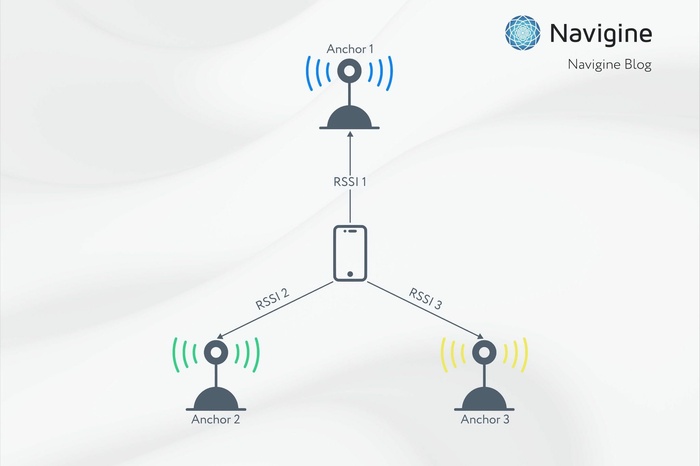
In most cases, Bluetooth® beacons, placed in various parts of the building, are used for enabling building navigation. Beacons resend signals at the preset intervals that are detected by the readers and then delivered to the server. After processing, the signals are transmitted to users’ smartphones in the form of relevant information.
On average, every room has to be equipped with no less than 10 beacons. They do not save data but work as transmitters. Beacons can be mounted on walls and ceilings, as well as other stationary objects, like columns, bars, doorposts. Navigine recommends mounting beacons in halls at a distance of 7-10 m from each other.
Stage 3. Creating localization and floor plan loading
After mounting the beacons, set up the location of your building in the Navigine platform. For this, the following parameters have to be stated in the special window:
- name of the place;
- coordinates (latitude and longitude);
- azimuth angle (if it is unknown, “0” can be input originally);
- sub-locations.
The functions of different programs for indoor positioning can vary significantly but the option of downloading a 2D plan of each floor of the building is common for all of them. Later it can be used for creating a digital indoor maps API for navigating. The map can be downloaded in different formats: .png, .jpg, or .svg. Ready indoor maps have geographical references to real dimensions, so they correlate with the 2D plan and the current coordinates of the location.
Stage 4. Creating POI (locations)
The next step is to define the key points of interest that will let users easily navigate the place in the future. Points of interest can be:
- any access points to the building, including entrances and exits, stairs, ramps, etc.;
- public facilities (cash points, payment terminals, vending machines, toilets, etc.);
- security points, such as security desks, first aid kits, lockers;
- other places (any room connected to your business, including conference halls, meeting rooms, etc.).
The marked locations improve the work of the mobile application and simplify the search of the required objects inside buildings. If necessary, any point can be presented in the form of a symbol that will be put on the map. If a person touches this symbol on the screen of the smartphone, the information on the place will be displayed.
Stage 5. Beacon arrangement on the map
While filling in the tabs in the Navigine platform, the physical location of the beacons should be added at the exact spot on the map using the tab ‘Add transmitter’. For adding a beacon, click the place on the map where the beacon is mounted and set the parameters:
- title;
- unique name;
- main identifier;
- minor identifier;
- radio signal strength.
After these steps, the beacon will appear on the map. Repeat the same steps for all other beacons.
Stage 6. Maintaining the map accuracy
The last step is to integrate CMS data and use an editor that will ensure the application update is performed by means of import and synchronization. Maintaining map accuracy is an important condition of the full-fledged work of indoor navigation. Updates should be input regularly after any changes to the place. Special event management tools have to be used for entering the dates and times of the forthcoming events.
Navigine tools make mapping consistent and accurate at all stages of work, including updates. Getting reliable information on object location guarantees the consistency of all the data in the system and significantly saves time while adding new information to the floor plan.
Possibilities of digital maps for users/ visitors and companies
Mapping has a positive effect on the company’s performance. The development of indoor maps creates conditions for effective marketing and provides business with new opportunities:
- defining object location for better building navigation;
- choosing the shortest and most convenient route to the points of interest (reduces the time for searching rooms and increases client loyalty);
- detecting the points of interest with the largest concentration of people (helps to create alternative routes);
- analytics of building usage to understand the behavior of visitors, defining the influx of people, detecting the most effective channels for attracting clients.
Mapping makes indoor navigation considerably easy and allows saving precious time wasted on searching for rooms or assets. With the help of indoor maps, managers are constantly aware of the location of the employees, can track equipment and vehicles, or prevent theft or loss of valuables.
Interesting cases in indoor mapping
We have explained how to create indoor navigation maps and now, in order to understand how indoor navigation works, let’s take a look at some interesting projects completed by Navigine.
Navigation for ‘Skolkovo’ Technopark
In 2006 Navigine started working with ‘Skolkovo’ Technopark which, at that time, was at the final stage of the construction process. The system of indoor navigation for assisting visitors in navigating around the place was specially developed for a new building of 96,000 sq m.
Bluetooth® Low Eenergy beacons and readers were mounted on the territory of the Technopark. At the same time, Navigine developed a mobile application that allowed users to quickly search for residents offices, book a meeting room, or make a business appointment. Using this technology, Skolkovo Technopark effectively organized numerous events, including the international level ones.
Mobile guide for the Kunstkamera
For the Peter the Great Museum of Anthropology and Ethnography (Kunstkamera) in St Petersburg, Navigine specifically developed a mobile application that simplifies the search for halls and exhibits. Our guide supplemented the already existing services and let the museum position itself as a state-of-the-art innovative space.

To facilitate indoor navigation in the museum, we mounted more than 120 beacons inside the building. While using the mobile application, visitors can see interactive maps of all the rooms, find the exhibits, and get additional information on every work of art. Positioning accuracy is up to 1 m. The system helps to build routes and automatically reproduces audio content as soon as a person gets close to the display.
What is important to pay attention to while choosing a solution provider?
In order to make indoor mapping manage the set tasks efficiently, one should consider carefully the choice of a navigation solution provider. You should take into account their experience, track record, scope of activity. It’s a good idea to read feedback on the Internet and get acquainted with the projects completed by the evaluated software providers. Make sure the provider’s software is available and easy to install, but, at the same time, without losing quality and navigation capabilities.
Navigine is ready for fruitful cooperation with business representatives, mobile developers, and system integrators. We provide our clients with effective building mapping software solutions that make it possible to develop user-friendly mobile apps for IOS and Android-based smartphones.
Benefits of partnership with our company:
- detailed instructions on implementing the code and running the software settings;
- experienced technical support;
- use of various navigation equipment according to the budget, aims, and priorities of the client;
- simple installation and easy scalability of the platform;
- cooperation with experts (our specialists have been developing navigation systems for more than 10 years);
- high positioning accuracy using the minimum number of equipment.
If you need high-quality indoor mapping, Navigine can help to develop efficient navigation tools that can be customized according to your needs and requirements.