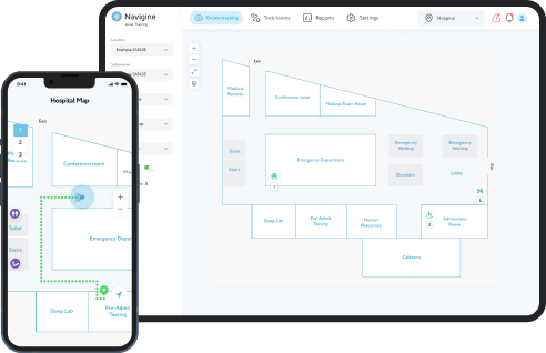
Open Source location API for integration into your development
Check our codeOpen source software is software with source code that anyone can inspect, modify, and enhance. Why do people prefer using open source?
Community
Open source software often inspires a community of users and developers to form around it.
Security
Anyone can view and modify software developed by using open source codes,, someone might spot and correct errors or omissions that a program's original authors might have missed
Control
People can examine the code to make sure it's not doing anything they don't want it to do, and they can change parts of it they don't like
Stability
Since programmers publicly distribute the source code for open source software, users relying on that software for critical tasks can be sure their tools won't disappear or fall into disrepair if their original creators stop working on them
Training
Other people like open source solutions because it helps them become better programmers. Because open source code is publicly accessible, students can easily study it as they learn to make better software
Navigine team supports the Open Source initiative by offering part of the algorithms for building navigation and indoor tracking. We believe that our code could bring significant benefits to third-party software developers. We regularly test new R&D activities to create extremely precise navigation systems.
Navigine’s mission in relation to Open Source is to
act as experts in the field of navigation algorithms.
Open source software often inspires a community of users and developers to form around it.
Teleport to GitHubIndoor Routing Library a set of navigation algorithms for working with the routing graph that are useful for creating location-powered solutions of Indoor Navigation and Wayfinding for various spaces and environments
iOS and Android Pedometer algorithm: estimates moment of persons' steps and thier length based on reading from accelerometer
Complementary filter algorithm: evaluates orientation in space by fusing data from gyroscope, magnetometer and acceleromete
Position estimator: gives current location as the position of nearest transmitter, based on the readings of the RSSI (a RSSI based algorithm for indoor localization).
GNSS navigation: Integrates GNSS positioning with an indoor solution to provide smooth transitioning between indoor and outdoor areas.
Radiomap localization: Provide an opportunity to create a navigation system without any additional equipment by measuring the radio map of the area and then using it as a reference for a KNN algorithm.
Solution postprocessing: Smoothing solution or fitting it to the predefined graph to get better visually pleasing results.
You can consult with our expert on this by sending email message to info@navigine.com
Once a month
From 0.5 to 10 meters depending on selected technology
We regularly release educational content on Youtube. Watch useful lectures on our channel!
Here you can point out some bugs if you found it in the code. We will be very grateful for this!
Discover the power of indoor positioning and tracking - contact us today!
Our Advantages